


Pylos is a highly historic area and one of Greece’s most beautiful and un-spoilt landscapes. As in many areas of Greece, tourism and other forms of development risk damaging the very landscape on which they depend. Recently the city of Pylos has degraded from its 19th century charm, and faces functional as well as aesthetic challenges due to seasonal influxes of visitors, and the unplanned use of cars.
The scope of this project is two-fold: the landscape assessment and proposals for the whole area’s landscape preservation, and the main strategies for the city of Pylos’ aesthetic and functional regeneration.
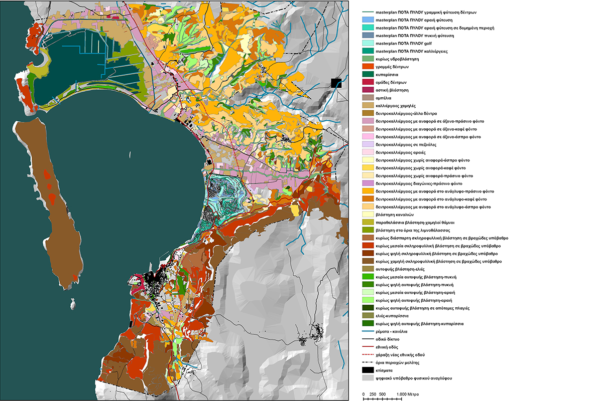
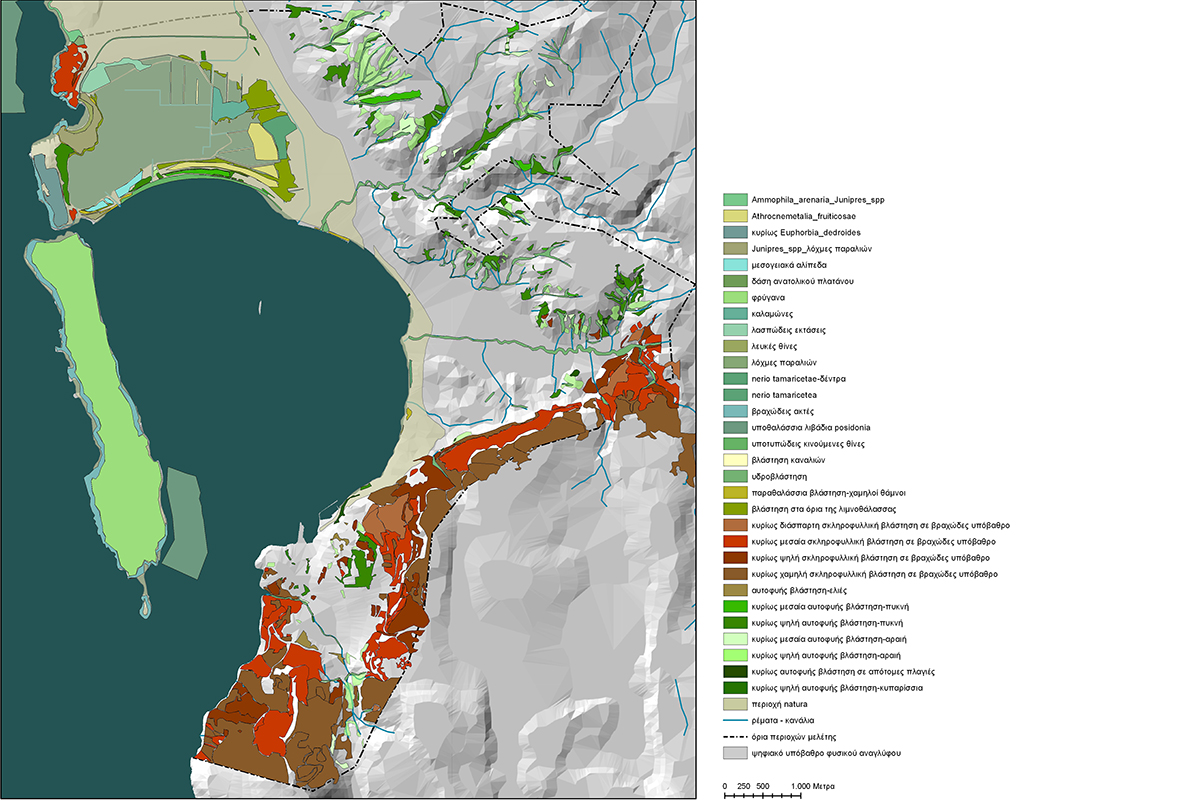
The landscape assessment leads to strategies for the protection, management and conservation of the area emphasising its special virtues. Specific zones of ecological, aesthetic and cultural value which require special protection are designated. Planned and unplanned regional dynamics that will affect these zones are identified, and preliminary measures for the establishment of a system of protection incorporating current government policies are proposed.
At a smaller scale architectural and landscape interventions are proposed, including the introduction of new uses for existing structures. These interventions are based on the provision of manageable and aesthetically beautiful access networks which incorporate lookouts for visitors, light modes of transport, educational and recreational activities, the marking of the national trail which passes through the area, as well as pointing out destination points of interest.
For the city of Pylos the proposal develops three strategies. The first is the re-establishment of the city’s central axis along the old stream-bed, which begins at the seafront and ends at the aqueduct at the south east edge of the city. Recreational, commercial and tourist activities are allocated along this axis, with a proposal for the revegetation and reformation of the river bed. The second strategy is the re-planning of the road network, using architectural and landscape design tools, with the aim of creating three main circulation networks allowing vehicles to travel at different speeds. The third strategy involves upgrading the existing urban spaces through the removal of layers of degrading additions, and the establishment of a clean, historically and aesthetically appropriate urban identity.


